Cinemaplugins LAZPoint v2.55 - Windows
OverviewLAZPoint is the ultimate LiDAR and point-cloud solution for Cinema 4D, delivering blazing-fast rendering of massive datasets with stunning clarity and precision. Whether you’re working with detailed terrain scans, architectural captures, or large-scale environmental data, LAZPoint lets you visualize and render point clouds directly inside Cinema 4D — without slowdowns or painful workarounds. Built for professionals who demand both speed and quality, LAZPoint handles huge LiDAR files with ease while preserving fine detail and natural depth. The result is a powerful, production-ready workflow for VFX, visualization, surveying, and 3D storytelling — giving you a beautifully accurate digital world to design, animate, and render inside Cinema 4D.
|
Features
- New – VLS virtual Laser scanner. Scan any C4D scene, as if you have a real laser scanner.
- New – LAS and LAZ export.
- New – Improved LAZRender. New 3D points as well as classic 2D points.
New – Many new options to resize and recolor points, as well as quantizing and clipping controls. All in real time. - Load massive, full color LIDAR data, directly into Cinema4D using LAS,LAZ , XYZ or PTS format, and render it, without any messing around.
- Unique ease of use, makes this the easiest solution there is, for loading and rendering point clouds. we spent a long time, making this as easy to use and intuitive as possible.
- Includes the amazing LAZRender engine, for the fastest possible rendering of huge point clouds, making this the easiest “Load and Render ” LIDAR solution, ever built.
- Handle hundreds of millions of points, in your editor, in realtime, even on moderate hardware.
- Create Point clouds from your scenes, by simply rendering them, and having LAZPoint capture that render for you, and give any scene, the LIDAR Look.
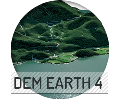
- Create Point clouds for any place on earth. When combined with DEM Earth, LAZPoint gives you a very special way to make a Point Cloud out of ordinary map and height data.
- Work with color point clouds, exported from programs such as Agisoft Photoscan, or RealityCapture . The First stage of photogrametry, is a point cloud.
Specs
Installation Requirements
In order to work properly, this product requires:
|
|
MAXON |

$68.11
Original: $227.05
-70%Cinemaplugins LAZPoint v2.55 - Windows—
$227.05
$68.11
Description
OverviewLAZPoint is the ultimate LiDAR and point-cloud solution for Cinema 4D, delivering blazing-fast rendering of massive datasets with stunning clarity and precision. Whether you’re working with detailed terrain scans, architectural captures, or large-scale environmental data, LAZPoint lets you visualize and render point clouds directly inside Cinema 4D — without slowdowns or painful workarounds. Built for professionals who demand both speed and quality, LAZPoint handles huge LiDAR files with ease while preserving fine detail and natural depth. The result is a powerful, production-ready workflow for VFX, visualization, surveying, and 3D storytelling — giving you a beautifully accurate digital world to design, animate, and render inside Cinema 4D.
|
Features
- New – VLS virtual Laser scanner. Scan any C4D scene, as if you have a real laser scanner.
- New – LAS and LAZ export.
- New – Improved LAZRender. New 3D points as well as classic 2D points.
New – Many new options to resize and recolor points, as well as quantizing and clipping controls. All in real time. - Load massive, full color LIDAR data, directly into Cinema4D using LAS,LAZ , XYZ or PTS format, and render it, without any messing around.
- Unique ease of use, makes this the easiest solution there is, for loading and rendering point clouds. we spent a long time, making this as easy to use and intuitive as possible.
- Includes the amazing LAZRender engine, for the fastest possible rendering of huge point clouds, making this the easiest “Load and Render ” LIDAR solution, ever built.
- Handle hundreds of millions of points, in your editor, in realtime, even on moderate hardware.
- Create Point clouds from your scenes, by simply rendering them, and having LAZPoint capture that render for you, and give any scene, the LIDAR Look.
- Create Point clouds for any place on earth. When combined with DEM Earth, LAZPoint gives you a very special way to make a Point Cloud out of ordinary map and height data.
- Work with color point clouds, exported from programs such as Agisoft Photoscan, or RealityCapture . The First stage of photogrametry, is a point cloud.
Specs
Installation Requirements
In order to work properly, this product requires:
|
|
MAXON |